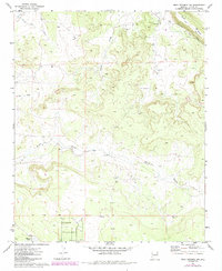
1971 Map of Mesa Redonda NW
USGS Topo · Published 1984About this map
Mesa Redonda rises as the dominant landform in this high-desert portion of Navajo County, defining a landscape shaped by drainage systems and ranching infrastructure. Arid watercourses including Hatch Draw, Hay Hollow Draw, and Concho Flat Wash carve the terrain, while human intervention is visible through the Canal and seasonal water catchments like Mexican Lake.
Find a feature on this map
12 named features on this map. Tap any name to fly to it.
Don’t see what you’re looking for? This feature index may not catch every label — zoom into the map to look around manually.
Map Details
Editions of this 1971 Mesa Redonda NW Map
3 editions found
Other maps of this area

1886 · St Johns
USGS Topo · 1:250,000

1886 · Holbrook
USGS Topo · 1:250,000

1892 · St Johns
USGS Topo · 1:250,000

1893 · Holbrook
USGS Topo · 1:250,000

1954 · Holbrook
USGS Topo · 1:250,000

1954 · Saint Johns
USGS Topo · 1:250,000

1955 · Adamana 3 SE
USGS Topo · 1:24,000

1957 · Holbrook
USGS Topo · 1:250,000

1957 · Saint Johns
USGS Topo · 1:250,000

1958 · Saint Johns
USGS Topo · 1:250,000