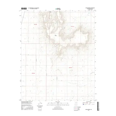
2017 Map of Mesa Redonda
USGS Topo · Published 2017About this map
Mesa Redonda rises prominently above the surrounding high plains of Quay County, anchoring a landscape defined by sharp drainage systems and broad plateaus. The topography is carved by numerous watercourses, including Barranca Cr to the south and the northern-draining Apodaca Cr and Rincon Cr. These intermittent streams cut through the rugged breaks, most notably at Spikes Canyon near the northern boundary.
Find a feature on this map
17 named features on this map. Tap any name to fly to it.
Don’t see what you’re looking for? This feature index may not catch every label — zoom into the map to look around manually.
Map Details
Editions of this 2017 Mesa Redonda Map
This is the sole edition of this map. No revisions or reprints were ever made.
Other maps of this area

1930 · Tucumcari
USGS Topo · 1:125,000

1954 · Tucumcari
USGS Topo · 1:250,000

1954 · Clovis
USGS Topo · 1:250,000

1958 · Clovis
USGS Topo · 1:250,000

1958 · Tucumcari
USGS Topo · 1:250,000

1968 · Bulldog Mesa
USGS Topo · 1:24,000
1968 · Briscoe Ranch
USGS Topo · 1:24,000
1968 · Tucumcari SE
USGS Topo · 1:24,000

1970 · Jordan
USGS Topo · 1:24,000

1970 · Quay
USGS Topo · 1:24,000