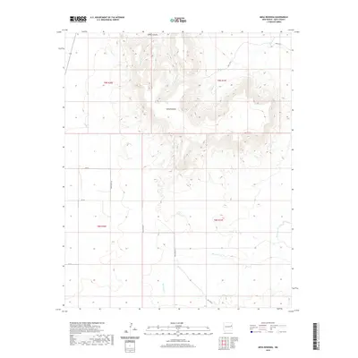
2020 Map of Mesa Redonda
USGS Topo · Published 2020About this map
Mesa Redonda dominates this portion of the New Mexico high plains, its massive landform creating a complex network of seasonal drainages. The northern portion of the quadrangle is defined by steep elevation changes where Spikes Canyon and Apodaca Cr carve into the plateau. These watercourses, along with Rincon Cr and Parris Cr, represent the fundamental geography of the region, dictating the placement of the sparse road network.
Find a feature on this map
19 named features on this map. Tap any name to fly to it.
Don’t see what you’re looking for? This feature index may not catch every label — zoom into the map to look around manually.
Map Details
Editions of this 2020 Mesa Redonda Map
This is the sole edition of this map. No revisions or reprints were ever made.
Other maps of this area

1930 · Tucumcari
USGS Topo · 1:125,000

1954 · Tucumcari
USGS Topo · 1:250,000

1954 · Clovis
USGS Topo · 1:250,000

1958 · Clovis
USGS Topo · 1:250,000

1958 · Tucumcari
USGS Topo · 1:250,000

1968 · Bulldog Mesa
USGS Topo · 1:24,000
1968 · Briscoe Ranch
USGS Topo · 1:24,000
1968 · Tucumcari SE
USGS Topo · 1:24,000

1970 · Jordan
USGS Topo · 1:24,000

1970 · Quay
USGS Topo · 1:24,000