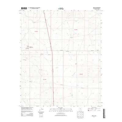
2013 Map of Mesa SE
USGS Topo · Published 2013About this map
Martin Ranch and Daniels Ranch anchor this landscape in Chaves County, characterized by a sophisticated network of water management features essential for ranching in the New Mexico high desert. The terrain is defined by the drainage of Fivemile Draw, which includes the Middle Fork Fivemile Draw and East Fork Fivemile Draw, directing seasonal runoff through a series of human-made reservoirs. These critical water sources, including Fivemile Tank, Cottonwood Tank, and Buffalo Tank, illustrate the adaptation of land use to the arid environment. A sparse grid of rural routes like Dona Ana Rd and Cottonwood Rd connect remote outposts such as Macho Ranch and the West Stancel Corral. The presence of the Askew Windmill and Partnership Well further highlights the historical reliance on groundwater to sustain livestock across these vast townships.
Find a feature on this map
24 named features on this map. Tap any name to fly to it.
Don’t see what you’re looking for? This feature index may not catch every label — zoom into the map to look around manually.
Map Details
Editions of this 2013 Mesa SE Map
This is the sole edition of this map. No revisions or reprints were ever made.
Other maps of this area

1955 · Roswell
USGS Topo · 1:250,000

1958 · Roswell
USGS Topo · 1:250,000

1962 · Roswell
USGS Topo · 1:250,000

1962 · Rock House Canyon
USGS Topo · 1:24,000

1962 · Marley Draw
USGS Topo · 1:24,000

1963 · Coyote Draw
USGS Topo · 1:24,000

1967 · Dunlap Sill
USGS Topo · 1:24,000

1967 · Swallow Nest Canyon
USGS Topo · 1:24,000
1967 · Mesa SE
USGS Topo · 1:24,000
1967 · Mesa SW
USGS Topo · 1:24,000