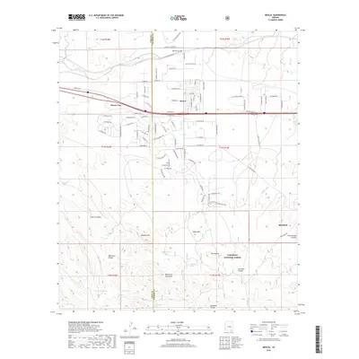
2018 Map of Mescal
USGS Topo · Published 2018About this map
Mescal and the neighboring residential area of Pimaco Two anchor this portion of the Arizona landscape, where high-desert ranch roads and a burgeoning grid of rural streets meet the open terrain of the Coronado National Forest. The map captures the interface between modern development and the enduring physical geography of the Whetstone Mountains. Numerous water sources, such as Little Nogales Spring, Silver Spring, and Nogales Spring, indicate the historical importance of local hydrology for both livestock and early settlement. To the east, the edge of Benson appears alongside prominent landmarks like Haystack Mtn and Easter Mtn. The terrain is marked by seasonal drainages including Mescal Arroyo and Cadillac Wash, while named canyons like Cherry Canyon and Anderson Canyon carve through the southern uplands, illustrating the complex drainage patterns of the San Pedro Valley watershed.
Find a feature on this map
70 named features on this map. Tap any name to fly to it.
Don’t see what you’re looking for? This feature index may not catch every label — zoom into the map to look around manually.
Map Details
Editions of this 2018 Mescal Map
This is the sole edition of this map. No revisions or reprints were ever made.
Other maps of this area

1904 · Patagonia
USGS Topo · 1:125,000

1904 · Tucson
USGS Topo · 1:125,000

1905 · Patagonia
USGS Topo · 1:125,000

1905 · Tucson
USGS Topo · 1:125,000

1915 · Benson
USGS Topo · 1:125,000

1926 · Whetstone
USGS Topo · 1:62,500

1943 · Benson
USGS Topo · 1:125,000

1945 · Happy Valley
USGS Topo · 1:62,500

1956 · Nogales
USGS Topo · 1:250,000

1956 · Tucson
USGS Topo · 1:250,000