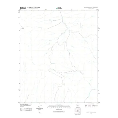
2011 Map of Mescal Warm Spring
USGS Topo · Published 2011About this map
Mescal Warm Spring and the surrounding high desert of Pinal County are defined by a complex network of ephemeral water sources and remote cattle ranching infrastructure. The Mescal Mountains dominate the central terrain, where drainage systems like Mescal Creek and Tulapai Creek carve through the arid landscape toward the Gila River in the south. This 2011 survey illustrates the precarious nature of water in the region, noting several vital named springs such as Red Whiskers Spring, Big Rock Spring, and Wild Horse Spring.
Find a feature on this map
23 named features on this map. Tap any name to fly to it.
Don’t see what you’re looking for? This feature index may not catch every label — zoom into the map to look around manually.
Map Details
Editions of this 2011 Mescal Warm Spring Map
This is the sole edition of this map. No revisions or reprints were ever made.
Other maps of this area

1901 · Globe
USGS Topo · 1:62,500

1902 · Globe
USGS Topo · 1:62,500

1910 · Ray
USGS Topo · 1:62,500

1915 · Christmas
USGS Topo · 1:62,500

1917 · Christmas
USGS Topo · 1:62,500

1954 · Mesa
USGS Topo · 1:250,000

1957 · Mesa
USGS Topo · 1:250,000

1958 · Mesa
USGS Topo · 1:250,000

1960 · Mesa
USGS Topo · 1:250,000

1964 · Mesa
USGS Topo · 1:250,000