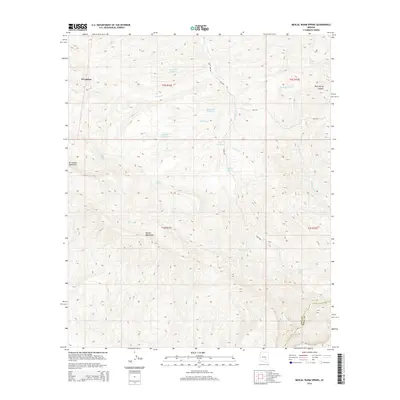
2014 Map of Mescal Warm Spring
USGS Topo · Published 2014About this map
Mescal Warm Spring and the Mescal Mountains dominate this arid landscape where the borders of Gila and Pinal counties meet. The terrain is defined by a complex network of seasonal drainages and springs that have long served as vital water sources in this high-desert environment. Notable hydrology includes Red Whiskers Spring, Wild Horse Spring, and Big Rock Spring, alongside man-made water management features like Bar F Bar Detention and Rock Gate Detention. The Gila River cuts across the southern portion of the quadrangle, serving as a primary geographical anchor. Infrastructure in this area is sparse, primarily consisting of Bureau of Indian Affairs routes such as Bia-700 and Bia-740, which navigate the slopes near El Capitan Mountain. This survey provides a precise record of water rights and topographic landmarks in a region defined by its sharp elevation changes and deep incisions like Dick Spring Canyon.
Find a feature on this map
29 named features on this map. Tap any name to fly to it.
Don’t see what you’re looking for? This feature index may not catch every label — zoom into the map to look around manually.
Map Details
Editions of this 2014 Mescal Warm Spring Map
This is the sole edition of this map. No revisions or reprints were ever made.
Other maps of this area

1901 · Globe
USGS Topo · 1:62,500

1902 · Globe
USGS Topo · 1:62,500

1910 · Ray
USGS Topo · 1:62,500

1915 · Christmas
USGS Topo · 1:62,500

1917 · Christmas
USGS Topo · 1:62,500

1954 · Mesa
USGS Topo · 1:250,000

1957 · Mesa
USGS Topo · 1:250,000

1958 · Mesa
USGS Topo · 1:250,000

1960 · Mesa
USGS Topo · 1:250,000

1964 · Mesa
USGS Topo · 1:250,000