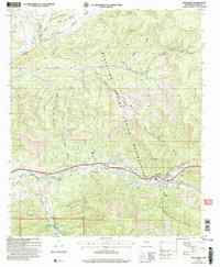
2004 Map of Mescalero
USGS Topo · Published 2006About this map
Tularosa Creek carves a critical corridor through this high-altitude landscape, where the Mescalero Apache Indian Reservation meets the northern boundary of the Lincoln National Forest. The settlement of Mescalero serves as a central hub, containing essential community infrastructure including a hospital, a fish hatchery, and a dedicated ceremonial ground. The geography is defined by deep incisions like Rinconada Canyon and Nogal Canyon, which direct the flow of numerous seasonal waters and permanent springs such as Church Spring and Telles Spring. Evidence of early 20th-century industry and land use is visible near the settlement of Bent, where several mines and a gravel pit are located. For genealogists, the map identifies specific burial sites including the Mescalero Indian Cemetery and Blazers Cem, alongside family-named landmarks like Carrillo Canyon and Pinkey Canyon.
Find a feature on this map
49 named features on this map. Tap any name to fly to it.
Don’t see what you’re looking for? This feature index may not catch every label — zoom into the map to look around manually.
Map Details
Editions of this 2004 Mescalero Map
This is the sole edition of this map. No revisions or reprints were ever made.
Other maps of this area

1950 · Sierra Blanca Peak
USGS Topo · 1:62,500

1950 · Mescalero
USGS Topo · 1:62,500

1955 · Roswell
USGS Topo · 1:250,000

1958 · Roswell
USGS Topo · 1:250,000

1962 · Roswell
USGS Topo · 1:250,000

1963 · Ruidoso
USGS Topo · 1:24,000

1963 · Firman Canyon
USGS Topo · 1:24,000

1963 · Apache Summit
USGS Topo · 1:24,000
1981 · Golondrina Draw
USGS Topo · 1:24,000
1981 · Cat Mountain
USGS Topo · 1:24,000