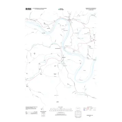
2013 Map of Meshoppen
USGS Topo · Published 2013About this map
The Susquehanna River defines the landscape of this Wyoming County region, carving deep bends like Jayne Bend and the sharp peninsula known as The Neck. In 2013, the river valley serves as a primary corridor for small settlements and infrastructure, including the Vosburg Tunnel and river-front communities like Meshoppen and Mehoopany. The terrain rises sharply from the river flats into the Endless Mountains, where landmarks like Maynard Hill and the Mehoopany Fire Tower overlook the valley. This survey captures a mix of rural aviation and riverfront recreation, noted by the presence of Chambers Airport and Nort's Resort Airport. The map also illustrates how historic travel routes, such as Old Route 6, navigate the winding water gaps between peaks like Blue Ridge Mountain and Doll Mountain.
Find a feature on this map
109 named features on this map. Tap any name to fly to it.
Don’t see what you’re looking for? This feature index may not catch every label — zoom into the map to look around manually.
Map Details
Editions of this 2013 Meshoppen Map
This is the sole edition of this map. No revisions or reprints were ever made.
Other maps of this area

1891 · Harveys Lake
USGS Topo · 1:62,500

1893 · Harvey Lake
USGS Topo · 1:62,500

1893 · Pittston
USGS Topo · 1:62,500

1943 · Scranton
USGS Topo · 1:125,000

1945 · Meshoppen
USGS Topo · 1:62,500

1945 · Auburn Center
USGS Topo · 1:24,000

1945 · Jenningsville
USGS Topo · 1:24,000

1945 · Meshoppen
USGS Topo · 1:24,000

1945 · Laceyville
USGS Topo · 1:24,000

1946 · Tunkhannock
USGS Topo · 1:62,500
Featured Places
- Mehoopany Township, PA
- Meshoppen, PA
- Forkston Township, PA
- Windham Township, PA
- North Mehoopany, Mehoopany Township