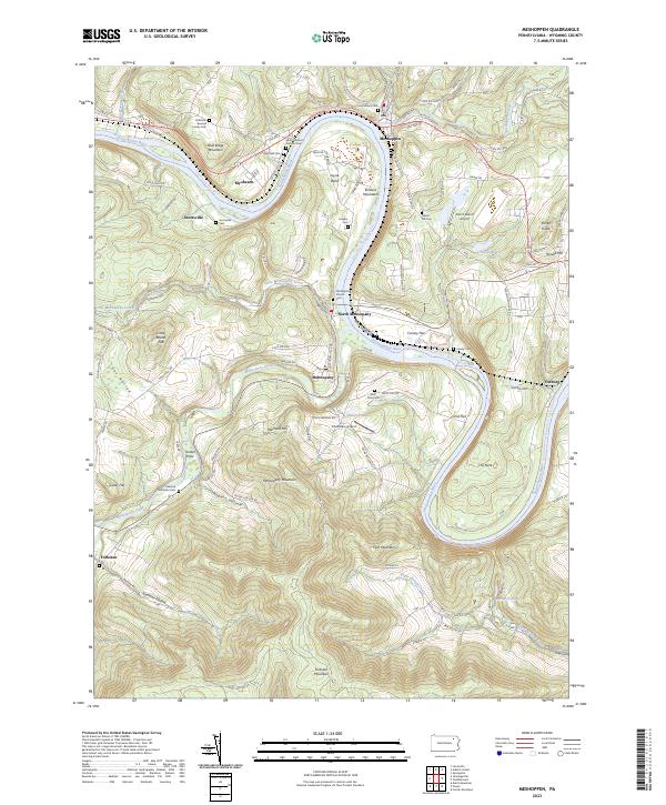
2023 Map of Meshoppen
USGS Topo · Published 2023About this map
Meshoppen and Mehoopany sit at the center of this landscape where the Susquehanna River carves a winding path through the Endless Mountains. The geography is defined by sharp river bends and elevation changes, from the prominent Mehoopany Mountain to the dramatic loop of the river known as The Neck. This area in Wyoming County maintains a strong connection to its early settlers, evidenced by numerous family burial grounds like the Solomon Bunnell Family Cem and the Overfield Cem.
Find a feature on this map
96 named features on this map. Tap any name to fly to it.
Don’t see what you’re looking for? This feature index may not catch every label — zoom into the map to look around manually.
Map Details
Editions of this 2023 Meshoppen Map
This is the sole edition of this map. No revisions or reprints were ever made.
Other maps of this area

1891 · Harveys Lake
USGS Topo · 1:62,500

1893 · Harvey Lake
USGS Topo · 1:62,500

1893 · Pittston
USGS Topo · 1:62,500

1943 · Scranton
USGS Topo · 1:125,000

1945 · Meshoppen
USGS Topo · 1:62,500

1945 · Auburn Center
USGS Topo · 1:24,000

1945 · Jenningsville
USGS Topo · 1:24,000

1945 · Meshoppen
USGS Topo · 1:24,000

1945 · Laceyville
USGS Topo · 1:24,000

1946 · Tunkhannock
USGS Topo · 1:62,500