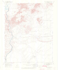
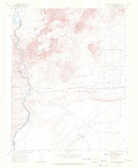
1967 Map of Mesito Reservoir
USGS Topo · Published 1971About this map
The Rio Grande carves through the landscape of Costilla County in this late 1960s study, defining the western edge of a region marked by geological transitions and land grants. The river's path is shadowed by the Grant Boundary, a significant line for local history researchers tracing property rights and original Spanish or Mexican land divisions. To the east, the Mesito Reservoir and its spillway collect the waters of Culebra Creek as it flows from the Sangre De Cristo foothills. The terrain is dominated by prominent elevations including Music Mesa, the Brownie Hills, and the San Luis Hills. Several locations labeled Prospect indicate historical mining interests near Sugar Loaf and within the enigmatic Death Valley, offering specific points of interest for those studying the area's mineral exploration history.
Find a feature on this map
12 named features on this map. Tap any name to fly to it.
Don’t see what you’re looking for? This feature index may not catch every label — zoom into the map to look around manually.
Map Details
Editions of this 1967 Mesito Reservoir Map
3 editions found
Other maps of this area

1954 · Trinidad
USGS Topo · 1:250,000

1955 · Trinidad
USGS Topo · 1:250,000

1958 · Trinidad
USGS Topo · 1:250,000

1959 · Trinidad
USGS Topo · 1:250,000

1965 · Lasauses
USGS Topo · 1:24,000

1965 · Blanca SE
USGS Topo · 1:24,000

1967 · Manassa NE
USGS Topo · 1:24,000
1967 · Sky Valley Ranch
USGS Topo · 1:24,000
1967 · Kiowa Hill
USGS Topo · 1:24,000
1967 · Mesito Reservoir
USGS Topo · 1:24,000