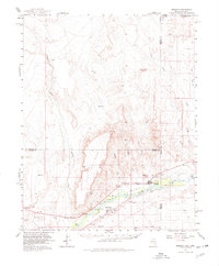
1957 Map of Mesquite
USGS Topo · Published 1978About this map
The Virgin River Valley serves as the primary corridor for life in this desert borderland, where the irrigation-fed settlements of Mesquite and Bunkerville anchor the southern reaches. This mid-century survey captures the region before its modern expansion, showing the proximity of the local Airport to the Nevada-Arizona boundary and the Cem that serves the pioneer community of Mesquite. The landscape is dominated by stark topographic features, including the sprawling Flat Top Mesa and an intricate network of drainage systems such as Toquop Wash, Sand Hollow Wash, and Pulsipher Wash. These seasonal watercourses carve through the high desert, leading toward the Virgin River, while prominent survey points like VABM Lone Mesa 2732 provide fixed markers in a territory defined by its complex plateaus and steep washes.
Find a feature on this map
23 named features on this map. Tap any name to fly to it.
Don’t see what you’re looking for? This feature index may not catch every label — zoom into the map to look around manually.
Map Details
Editions of this 1957 Mesquite Map
2 editions found

Other maps of this area

1885 · St. George
USGS Topo · 1:250,000

1885 · Pioche
USGS Topo · 1:250,000

1886 · Saint Thomas
USGS Topo · 1:250,000

1886 · Mt. Trumbull
USGS Topo · 1:250,000

1886 · Pioche
USGS Topo · 1:250,000

1891 · St. George
USGS Topo · 1:250,000

1892 · Mt. Trumbull
USGS Topo · 1:250,000

1893 · Saint Thomas
USGS Topo · 1:250,000

1953 · Cedar City
USGS Topo · 1:250,000

1953 · Grand Canyon
USGS Topo · 1:250,000