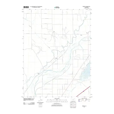
2010 Map of Messex
USGS Topo · Published 2010About this map
The South Platte River carves a broad valley through this portion of Logan County, defining a landscape dominated by sophisticated irrigation engineering. A dense network of man-made waterways, including the Riverside Intake Canal, North Sterling Canal, and Pawnee Ditch, diverts river water to support agricultural life in the high plains. This reliance on water management is further evidenced by the Prewitt Inlet Canal leading into the substantial Prewitt Reservoir at the southeastern edge of the map.
Find a feature on this map
44 named features on this map. Tap any name to fly to it.
Don’t see what you’re looking for? This feature index may not catch every label — zoom into the map to look around manually.
Map Details
Editions of this 2010 Messex Map
This is the sole edition of this map. No revisions or reprints were ever made.
Other maps of this area

1951 · Willard
USGS Topo · 1:24,000

1951 · Messex
USGS Topo · 1:24,000

1951 · Antelope Springs
USGS Topo · 1:24,000

1951 · Merino SW
USGS Topo · 1:24,000

1951 · Brush East
USGS Topo · 1:24,000

1951 · Merino SE
USGS Topo · 1:24,000

1951 · Merino
USGS Topo · 1:24,000

1951 · Atwood
USGS Topo · 1:24,000

1954 · Sterling
USGS Topo · 1:250,000

1958 · Sterling
USGS Topo · 1:250,000