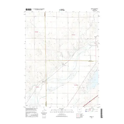
2016 Map of Messex
USGS Topo · Published 2016About this map
The South Platte River carves a broad corridor through the eastern Colorado plains, creating a complex network of irrigation infrastructure essential to the region's agricultural history. Small settlements like Beta, Messex, and Balzac serve as anchors along the river valley, while the Merino Cem provides a point of genealogical interest near the Logan County line. The map reveals an intricate system of water management, with the Pawnee Ditch, S Platte Ditch, and North Sterling Canal crisscrossing the landscape to support local farms. To the southeast, the substantial Prewitt Reservoir and its associated Prewitt Outlet Canal dominate the terrain, reflecting the scale of water storage required in this environment. This survey captures a specific tri-county intersection where Morgan, Logan, and Washington counties meet, illustrating the rural road grid and the dry channel of L F Draw.
Find a feature on this map
48 named features on this map. Tap any name to fly to it.
Don’t see what you’re looking for? This feature index may not catch every label — zoom into the map to look around manually.
Map Details
Editions of this 2016 Messex Map
This is the sole edition of this map. No revisions or reprints were ever made.
Other maps of this area

1951 · Willard
USGS Topo · 1:24,000

1951 · Messex
USGS Topo · 1:24,000

1951 · Antelope Springs
USGS Topo · 1:24,000

1951 · Merino SW
USGS Topo · 1:24,000

1951 · Brush East
USGS Topo · 1:24,000

1951 · Merino SE
USGS Topo · 1:24,000

1951 · Merino
USGS Topo · 1:24,000

1951 · Atwood
USGS Topo · 1:24,000

1954 · Sterling
USGS Topo · 1:250,000

1958 · Sterling
USGS Topo · 1:250,000