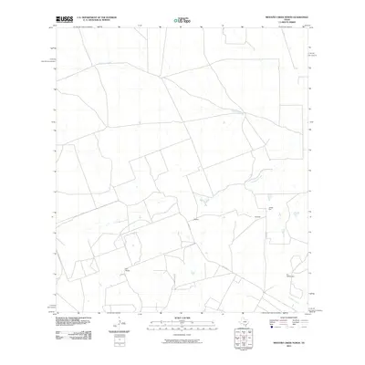
2010 Map of Mesteno Creek North
USGS Topo · Published 2010About this map
Las Raices Creek and Pelon Ciz Creek define the drainage patterns of this South Texas landscape, where large ranching interests and scattered rural homesteads predominate. The map identifies specific property locations or residences associated with family names such as Mrs Brown, J Rector, H Garcia, James Carr, and R J Wellhausen, providing valuable data points for land ownership research and genealogy in Webb County. Transport through this area is largely facilitated by Raices Rd, which crosses the southern portion of the sheet. To the southeast, Tecolate Creek flows through a terrain marked by intermittent watercourses, reflecting the arid nature of the brush country. This survey illustrates the continued importance of specific family-held tracts and the sparse, creek-oriented settlement typical of the region into the early twenty-first century.
Find a feature on this map
10 named features on this map. Tap any name to fly to it.
Don’t see what you’re looking for? This feature index may not catch every label — zoom into the map to look around manually.
Map Details
Editions of this 2010 Mesteno Creek North Map
This is the sole edition of this map. No revisions or reprints were ever made.
Other maps of this area

1927 · Bart
USGS Topo · 1:62,500

1929 · Cotulla
USGS Topo · 1:125,000

1932 · Valley Wells
USGS Topo · 1:62,500

1940 · Velenzuela Creek
USGS Topo · 1:62,500

1940 · Catarina
USGS Topo · 1:62,500

1940 · Artesia Wells
USGS Topo · 1:62,500

1953 · Crystal City
USGS Topo · 1:250,000

1955 · Crystal City
USGS Topo · 1:250,000

1957 · Encinal
USGS Topo · 1:62,500

1961 · Crystal City
USGS Topo · 1:250,000