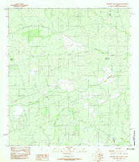
1982 Map of Mesteno Creek North
USGS Topo · Published 1982About this map
Mesteño Creek and Pelon Creek wind through this South Texas landscape where the boundaries of Webb, Dimmit, and La Salle counties converge. This 1982 provisional survey, based on aerial photography from the mid-1970s, captures a sparsely settled region defined by its hydrography and shifting drainage patterns. The course of Las Raices Creek and the smaller Tecolote Creek dominate the topography, illustrating the natural water network that dictated land use in this corner of the state. The map serves as a primary record of the terrain before later developments, detailing the intricate creek beds and elevations that characterize the brush country near the tri-county intersection.
Find a feature on this map
7 named features on this map. Tap any name to fly to it.
Don’t see what you’re looking for? This feature index may not catch every label — zoom into the map to look around manually.
Map Details
Editions of this 1982 Mesteno Creek North Map
This is the sole edition of this map. No revisions or reprints were ever made.
Other maps of this area

1927 · Bart
USGS Topo · 1:62,500

1929 · Cotulla
USGS Topo · 1:125,000

1932 · Valley Wells
USGS Topo · 1:62,500

1940 · Velenzuela Creek
USGS Topo · 1:62,500

1940 · Catarina
USGS Topo · 1:62,500

1940 · Artesia Wells
USGS Topo · 1:62,500

1953 · Crystal City
USGS Topo · 1:250,000

1955 · Crystal City
USGS Topo · 1:250,000

1957 · Encinal
USGS Topo · 1:62,500

1961 · Crystal City
USGS Topo · 1:250,000