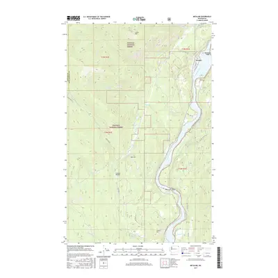
2017 Map of Metaline
USGS Topo · Published 2017About this map
Metaline Falls and the town of Metaline anchor the northern reaches of the Pend Oreille River as it carves through the Colville National Forest. This section of northeast Washington is defined by the river’s engineering and natural mountain terrain, where the Box Canyon Reservoir and Box Canyon itself reveal the industrial and hydroelectric history of the valley. Significant family-history markers are preserved here, notably the Perkins Family Cem located near the riverbank north of Wolf Creek.
Find a feature on this map
45 named features on this map. Tap any name to fly to it.
Don’t see what you’re looking for? This feature index may not catch every label — zoom into the map to look around manually.
Map Details
Editions of this 2017 Metaline Map
This is the sole edition of this map. No revisions or reprints were ever made.
Other maps of this area

1929 · Colville
USGS Topo · 1:125,000

1933 · Colville
USGS Topo · 1:125,000

1934 · Metaline
USGS Topo · 1:125,000

1942 · Metaline
USGS Topo · 1:125,000

1952 · Deep Lake
USGS Topo · 1:24,000

1952 · Leadpoint
USGS Topo · 1:24,000

1958 · Sandpoint
USGS Topo · 1:250,000

1963 · Sandpoint
USGS Topo · 1:250,000
1967 · Aladdin Mtn
USGS Topo · 1:24,000

1967 · Ione
USGS Topo · 1:24,000