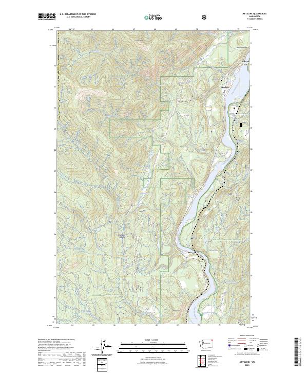
2023 Map of Metaline
USGS Topo · Published 2023About this map
The Pend Oreille River carves a deep path through the northeast corner of Washington, defining the landscape around Metaline Falls and the neighboring settlement of Metaline. This 2023 edition documents the area's intricate topography within the Colville National Forest, featuring prominent heights like Linton Mtn and Deer Mtn. Local history is anchored by sites such as the Metaline Cem and Perkins Family Cem, which sit near the river's edge. The waterway transitions through the dramatic Box Canyon, a narrow passage that has historically influenced navigation and industry in this remote mountain corridor. High-elevation clearings like Thorson Meadow and Cameron Meadow contrast with the dense forest, while the Cedar Cr Reservoir to the south indicates the managed water resources essential to the region's development.
Find a feature on this map
36 named features on this map. Tap any name to fly to it.
Don’t see what you’re looking for? This feature index may not catch every label — zoom into the map to look around manually.
Map Details
Editions of this 2023 Metaline Map
This is the sole edition of this map. No revisions or reprints were ever made.
Other maps of this area

1929 · Colville
USGS Topo · 1:125,000

1933 · Colville
USGS Topo · 1:125,000

1934 · Metaline
USGS Topo · 1:125,000

1942 · Metaline
USGS Topo · 1:125,000

1952 · Deep Lake
USGS Topo · 1:24,000

1952 · Leadpoint
USGS Topo · 1:24,000

1958 · Sandpoint
USGS Topo · 1:250,000

1963 · Sandpoint
USGS Topo · 1:250,000
1967 · Aladdin Mtn
USGS Topo · 1:24,000

1967 · Ione
USGS Topo · 1:24,000