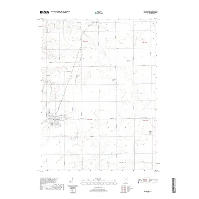
2018 Map of Metamora
USGS Topo · Published 2018About this map
Metamora serves as a primary hub of settlement in this part of Woodford County, showing a detailed street grid including W Madison St and S Prairie St. The surrounding landscape is defined by a network of drainage systems like the Partridge River and Walnut Cr, which carve through the agricultural tablelands. The small settlement of Cazenovia sits to the north along the railroad corridor, while Morristown is marked near a local Cem. Rural life is further evidenced by several small private airfields, including the Jay Schertz Farm Airport and Michael Pfister Airport, scattered among the section lines. This 2018 survey documents the persistent rural character of the Illinois prairie, where the placement of the Harmony Cem and County Cem provides stable reference points for genealogists tracing family roots in the townships of t27n r2w and t28n r2w.
Find a feature on this map
48 named features on this map. Tap any name to fly to it.
Don’t see what you’re looking for? This feature index may not catch every label — zoom into the map to look around manually.
Map Details
Editions of this 2018 Metamora Map
This is the sole edition of this map. No revisions or reprints were ever made.
Other maps of this area

1893 · Metamora
USGS Topo · 1:62,500

1927 · Danvers
USGS Topo · 1:62,500

1928 · Mackinaw
USGS Topo · 1:62,500

1930 · Danvers
USGS Topo · 1:62,500

1932 · Mackinaw
USGS Topo · 1:62,500

1937 · Metamora
USGS Topo · 1:62,500

1948 · Metamora
USGS Topo · 1:62,500

1955 · Minonk
USGS Topo · 1:62,500

1958 · Peoria
USGS Topo · 1:250,000

1961 · Peoria
USGS Topo · 1:250,000