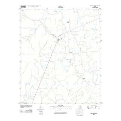
2010 Map of Metcalf Gap
USGS Topo · Published 2010About this map
The Palo Pinto Mountains dominate this central Texas landscape, creating a series of strategic natural passages such as Metcalf Gap and Springer Gap. This region, documented during the late 2000s, shows a sparse settlement pattern characteristic of the Cross Timbers, where local life centers on crossroads and community landmarks like the Dodson Prairie Community Hall. The terrain is deeply incised by a network of drainage systems, including Ioni Creek, Little Ioni Creek, and Honey Creek, which wind around prominent elevations like Antelope Mountain and Sugarloaf Mountain. Economic activity is represented by the Metcalf Gap Oil Field, indicating the ongoing importance of energy extraction in the area. Local infrastructure is defined by named rural routes such as Church House Rd and Dodson Prairie Rd, which connect isolated homesteads and ranch lands across the broken topography.
Find a feature on this map
28 named features on this map. Tap any name to fly to it.
Don’t see what you’re looking for? This feature index may not catch every label — zoom into the map to look around manually.
Map Details
Editions of this 2010 Metcalf Gap Map
This is the sole edition of this map. No revisions or reprints were ever made.
Other maps of this area

1890 · Breckenridge
USGS Topo · 1:125,000

1891 · Palo Pinto
USGS Topo · 1:125,000

1918 · Palo Pinto
USGS Topo · 1:125,000

1924 · Palo Pinto 2-c
USGS Topo · 1:48,000

1924 · Breckenridge 1-d
USGS Topo · 1:48,000

1927 · Pickwick
USGS Topo · 1:62,500

1931 · Ivan
USGS Topo · 1:62,500

1954 · Abilene
USGS Topo · 1:250,000

1958 · Abilene
USGS Topo · 1:250,000

1958 · Palo Pinto
USGS Topo · 1:62,500