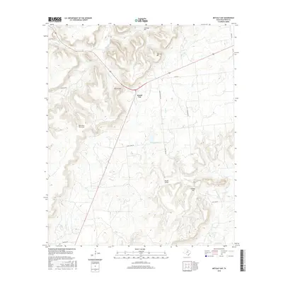
2016 Map of Metcalf Gap
USGS Topo · Published 2016About this map
Metcalf Gap serves as a critical passage through the Palo Pinto Mountains in this central Texas landscape. The terrain is defined by dramatic elevation changes, where prominent summits like Sugarloaf Mtn and Antelope Mtn overlook a complex network of seasonal drainages. Waterways such as Little Joni Cr and Eagle Cr carve through the limestone-rich topography, eventually feeding into Hodgkins Lake or winding through corridors like Brushy Hollow.
Find a feature on this map
26 named features on this map. Tap any name to fly to it.
Don’t see what you’re looking for? This feature index may not catch every label — zoom into the map to look around manually.
Map Details
Editions of this 2016 Metcalf Gap Map
This is the sole edition of this map. No revisions or reprints were ever made.
Other maps of this area

1890 · Breckenridge
USGS Topo · 1:125,000

1891 · Palo Pinto
USGS Topo · 1:125,000

1918 · Palo Pinto
USGS Topo · 1:125,000

1924 · Palo Pinto 2-c
USGS Topo · 1:48,000

1924 · Breckenridge 1-d
USGS Topo · 1:48,000

1927 · Pickwick
USGS Topo · 1:62,500

1931 · Ivan
USGS Topo · 1:62,500

1954 · Abilene
USGS Topo · 1:250,000

1958 · Abilene
USGS Topo · 1:250,000

1958 · Palo Pinto
USGS Topo · 1:62,500