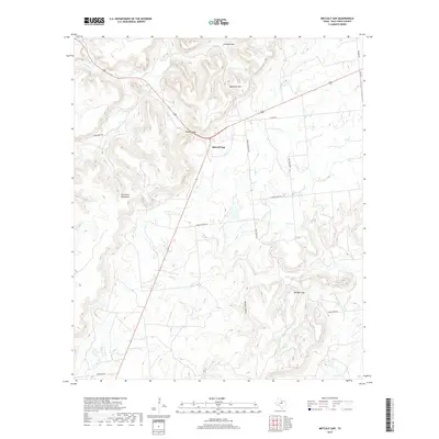
2019 Map of Metcalf Gap
USGS Topo · Published 2019About this map
Metcalf Gap serves as the topographic centerpiece of this Palo Pinto County landscape, where US Highway 180 cuts through the southern reach of the Palo Pinto Mountains. The terrain is defined by dramatic elevation changes, notably at Antelope Mtn and Sugarloaf Mtn in the north, and Springer Gap to the southeast. These ridges divide several localized drainage basins, including the headwaters of Eagle Cr, Ioni Cr, and Lake Cr. While the area remains largely rural and defined by its physical geography, the network of local roads such as School House Rd and Church House Rd suggests the historical locations of community landmarks. The map details a complex system of seasonal draws and hollows, such as Brushy Hollow, which feed into the larger creek systems that have shaped the ranching and transit corridors of North Central Texas for generations.
Find a feature on this map
25 named features on this map. Tap any name to fly to it.
Don’t see what you’re looking for? This feature index may not catch every label — zoom into the map to look around manually.
Map Details
Editions of this 2019 Metcalf Gap Map
This is the sole edition of this map. No revisions or reprints were ever made.
Other maps of this area

1890 · Breckenridge
USGS Topo · 1:125,000

1891 · Palo Pinto
USGS Topo · 1:125,000

1918 · Palo Pinto
USGS Topo · 1:125,000

1924 · Palo Pinto 2-c
USGS Topo · 1:48,000

1924 · Breckenridge 1-d
USGS Topo · 1:48,000

1927 · Pickwick
USGS Topo · 1:62,500

1931 · Ivan
USGS Topo · 1:62,500

1954 · Abilene
USGS Topo · 1:250,000

1958 · Abilene
USGS Topo · 1:250,000

1958 · Palo Pinto
USGS Topo · 1:62,500