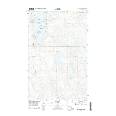
2014 Map of Metigoshe Lake
USGS Topo · Published 2014About this map
Metigoshe Lake dominates the northwest corner of this Bottineau County landscape, straddling the international boundary within the Turtle Mountains. The complex shoreline of the lake is defined by residential developments and leisure sites including Masonic Island, Bear Island, and Mackay Island, all situated near the central passage known as The Narrows. This early 21st-century survey illustrates the intricate relationship between the region's dense kettle-lake topography and its modern recreational infrastructure, with numerous seasonal roads like Sunset Bay Rd and Glen Acre Rd providing access to points like Rugby Point and Squaw Point. Beyond the main lake, the terrain transitions into a more secluded wetland environment characterized by smaller bodies of water such as School Section Lake, Pelican Lake, and Bear Lake to the south.
Find a feature on this map
62 named features on this map. Tap any name to fly to it.
Don’t see what you’re looking for? This feature index may not catch every label — zoom into the map to look around manually.
Map Details
Editions of this 2014 Metigoshe Lake Map
This is the sole edition of this map. No revisions or reprints were ever made.
Other maps of this area

1935 · Dunseith
USGS Topo · 1:48,000

1939 · Dunseith
USGS Topo · 1:62,500

1954 · Minot
USGS Topo · 1:250,000

1955 · Lords Lake
USGS Topo · 1:24,000

1955 · Bottineau
USGS Topo · 1:24,000

1955 · Bottineau SE
USGS Topo · 1:24,000

1956 · Metigoshe Lake
USGS Topo · 1:24,000

1956 · Lake McArthur
USGS Topo · 1:24,000
1956 · Lords Lake
USGS Topo · 1:25,000

1958 · Minot
USGS Topo · 1:250,000