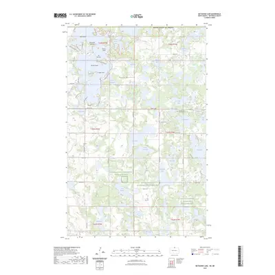
2023 Map of Metigoshe Lake
USGS Topo · Published 2023About this map
The Turtle Mountains dominate this borderland landscape, where a dense network of glacial lakes defines the transition between North Dakota and Canada. Metigoshe Lake is the primary feature, characterized by complex shorelines and named points like Rugby Point and Masonic Island. The settlement pattern is largely recreational and rural, with residential developments clustered near The Narrows and along various bay roads.
Find a feature on this map
66 named features on this map. Tap any name to fly to it.
Don’t see what you’re looking for? This feature index may not catch every label — zoom into the map to look around manually.
Map Details
Editions of this 2023 Metigoshe Lake Map
This is the sole edition of this map. No revisions or reprints were ever made.
Other maps of this area

1935 · Dunseith
USGS Topo · 1:48,000

1939 · Dunseith
USGS Topo · 1:62,500

1954 · Minot
USGS Topo · 1:250,000

1955 · Lords Lake
USGS Topo · 1:24,000

1955 · Bottineau
USGS Topo · 1:24,000

1955 · Bottineau SE
USGS Topo · 1:24,000

1956 · Metigoshe Lake
USGS Topo · 1:24,000

1956 · Lake McArthur
USGS Topo · 1:24,000
1956 · Lords Lake
USGS Topo · 1:25,000

1958 · Minot
USGS Topo · 1:250,000