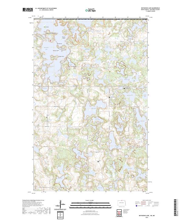
2024 Map of Metigoshe Lake
USGS Topo · Published 2024About this map
The Turtle Mountains plateau defines this North Dakota landscape, where glacial depressions have created a dense network of lakes and wetlands along the international border. Much of the human activity is concentrated around Metigoshe Lake, featuring seasonal and permanent developments at Rugby Point and along Le Shore Pk Rd. Several islands, including Masonic Island and Bear Island, dot the water, while the narrow channel known as The Narrows connects the larger basins.
Find a feature on this map
64 named features on this map. Tap any name to fly to it.
Don’t see what you’re looking for? This feature index may not catch every label — zoom into the map to look around manually.
Map Details
Editions of this 2024 Metigoshe Lake Map
This is the sole edition of this map. No revisions or reprints were ever made.
Other maps of this area

1935 · Dunseith
USGS Topo · 1:48,000

1939 · Dunseith
USGS Topo · 1:62,500

1954 · Minot
USGS Topo · 1:250,000

1955 · Lords Lake
USGS Topo · 1:24,000

1955 · Bottineau
USGS Topo · 1:24,000

1955 · Bottineau SE
USGS Topo · 1:24,000

1956 · Metigoshe Lake
USGS Topo · 1:24,000

1956 · Lake McArthur
USGS Topo · 1:24,000
1956 · Lords Lake
USGS Topo · 1:25,000

1958 · Minot
USGS Topo · 1:250,000