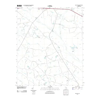
2011 Map of Metter SE
USGS Topo · Published 2011About this map
The Canoochee River and its intricate network of tributaries, including Fifteenmile Creek and Wolfe Creek, define this area of southeastern Georgia. The landscape is characterized by a high concentration of private impoundments and named water bodies such as Laniers Pond, Glisson Lake, and Hensley Lake, each supported by its own dam. This hydrological pattern reflects the regional reliance on managed water resources for agriculture and local recreation.
Find a feature on this map
77 named features on this map. Tap any name to fly to it.
Don’t see what you’re looking for? This feature index may not catch every label — zoom into the map to look around manually.
Map Details
Editions of this 2011 Metter SE Map
This is the sole edition of this map. No revisions or reprints were ever made.
Other maps of this area

1919 · Claxton
USGS Topo · 1:62,500

1920 · Statesboro
USGS Topo · 1:62,500

1943 · Statesboro
USGS Topo · 1:62,500

1944 · Claxton
USGS Topo · 1:62,500

1947 · Savannah
USGS Topo · 1:250,000

1948 · Savannah
USGS Topo · 1:250,000

1950 · Claxton
USGS Topo · 1:62,500

1957 · Macon
USGS Topo · 1:250,000

1957 · Savannah
USGS Topo · 1:250,000

1958 · Macon
USGS Topo · 1:250,000