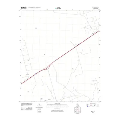
2010 Map of Metz
USGS Topo · Published 2010About this map
The Yarbrough Allen Oil Field and the surrounding Ector County plains define this landscape, where energy extraction and cattle ranching have long coexisted. In the early 21st century, the small settlements of Metz and Judkins anchor a terrain crisscrossed by essential ranching infrastructure. Numerous named water sources, such as Buffalo Windmill, PrairieHome Windmill, and McClain Windmill, are scattered across the quadrangle, illustrating the vital role of groundwater management in this arid region. The industrial character of the area is further emphasized by the Metz Oil Field, while the presence of Shoe Bar Ranch Rd and Ranch Rd 1053 highlights the transportation corridors connecting isolated ranch houses and drilling sites to the larger Texas network.
Find a feature on this map
14 named features on this map. Tap any name to fly to it.
Don’t see what you’re looking for? This feature index may not catch every label — zoom into the map to look around manually.
Map Details
Editions of this 2010 Metz Map
This is the sole edition of this map. No revisions or reprints were ever made.
Other maps of this area

1954 · Pecos
USGS Topo · 1:250,000

1957 · Pecos
USGS Topo · 1:250,000

1964 · Douro
USGS Topo · 1:24,000

1964 · Metz
USGS Topo · 1:24,000

1964 · Red Lakes
USGS Topo · 1:24,000

1964 · Penwell SW
USGS Topo · 1:24,000

1964 · Penwell
USGS Topo · 1:24,000

1964 · Penwell SE
USGS Topo · 1:24,000

1968 · Monahans SE
USGS Topo · 1:24,000

1968 · Cowden Place
USGS Topo · 1:24,000