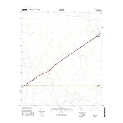
2016 Map of Metz
USGS Topo · Published 2016About this map
The West Texas horizon near the border of Ector Co and Crane Co is defined by the critical transit corridor of W Interstate 20 State Rte N. This 2016 survey documents the sparse settlement patterns of the Permian Basin, where the small community of Metz and the neighboring locale of Judkins sit adjacent to the heavy automotive and industrial traffic of the interstate. The landscape is a network of access points and ranching arteries, including I20 Svc Rd and Ranch Rd 1053.
Find a feature on this map
9 named features on this map. Tap any name to fly to it.
Don’t see what you’re looking for? This feature index may not catch every label — zoom into the map to look around manually.
Map Details
Editions of this 2016 Metz Map
This is the sole edition of this map. No revisions or reprints were ever made.
Other maps of this area

1954 · Pecos
USGS Topo · 1:250,000

1957 · Pecos
USGS Topo · 1:250,000

1964 · Douro
USGS Topo · 1:24,000

1964 · Metz
USGS Topo · 1:24,000

1964 · Red Lakes
USGS Topo · 1:24,000

1964 · Penwell SW
USGS Topo · 1:24,000

1964 · Penwell
USGS Topo · 1:24,000

1964 · Penwell SE
USGS Topo · 1:24,000

1968 · Monahans SE
USGS Topo · 1:24,000

1968 · Cowden Place
USGS Topo · 1:24,000