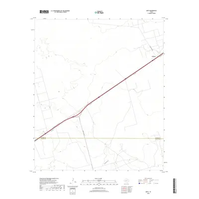
2019 Map of Metz
USGS Topo · Published 2019About this map
W Interstate 20 State Rte N cuts a diagonal path across this West Texas landscape, serving as the primary corridor through the high plains of the Permian Basin. Near the eastern edge of the sheet, the small settlement of Judkins sits adjacent to the interstate, positioned where Shoe Bar Ranch Rd heads north into the open ranchland. This 2019 survey illustrates a landscape primarily defined by modern energy infrastructure and large-scale ranching operations, marked by a network of local roads such as McKnight Rnch Rd and Ranch Rd 1053. The terrain is characterized by subtle elevation changes and numerous depressions, typical of the arid geography found along the boundary between Ector Co and Crane Co.
Find a feature on this map
8 named features on this map. Tap any name to fly to it.
Don’t see what you’re looking for? This feature index may not catch every label — zoom into the map to look around manually.
Map Details
Editions of this 2019 Metz Map
This is the sole edition of this map. No revisions or reprints were ever made.
Other maps of this area

1954 · Pecos
USGS Topo · 1:250,000

1957 · Pecos
USGS Topo · 1:250,000

1964 · Douro
USGS Topo · 1:24,000

1964 · Metz
USGS Topo · 1:24,000

1964 · Red Lakes
USGS Topo · 1:24,000

1964 · Penwell SW
USGS Topo · 1:24,000

1964 · Penwell
USGS Topo · 1:24,000

1964 · Penwell SE
USGS Topo · 1:24,000

1968 · Monahans SE
USGS Topo · 1:24,000

1968 · Cowden Place
USGS Topo · 1:24,000