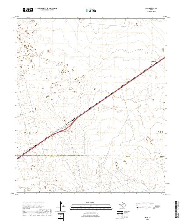
2022 Map of Metz
USGS Topo · Published 2022About this map
The West Texas landscape around the small settlement of Judkins is defined by its wide, open expanse and the vital transportation corridors that cut through the Permian Basin. This modern survey illustrates the intersection of major transit and local ranching infrastructure, where W Interstate 20 State Rte N serves as the primary artery through Ector County. The map provides a clear view of the jurisdictional boundary dividing Ector Co and Crane Co, a line that bisects the southern portion of this region. Secondary roads like Ranch Rd 1053 and McKnight Rnch Rd provide access into the surrounding countryside, highlighting the practical network used for land management and travel across the flat, high-desert terrain.
Find a feature on this map
5 named features on this map. Tap any name to fly to it.
Don’t see what you’re looking for? This feature index may not catch every label — zoom into the map to look around manually.
Map Details
Editions of this 2022 Metz Map
This is the sole edition of this map. No revisions or reprints were ever made.
Other maps of this area

1954 · Pecos
USGS Topo · 1:250,000

1957 · Pecos
USGS Topo · 1:250,000

1964 · Douro
USGS Topo · 1:24,000

1964 · Metz
USGS Topo · 1:24,000

1964 · Red Lakes
USGS Topo · 1:24,000

1964 · Penwell SW
USGS Topo · 1:24,000

1964 · Penwell
USGS Topo · 1:24,000

1964 · Penwell SE
USGS Topo · 1:24,000

1968 · Monahans SE
USGS Topo · 1:24,000

1968 · Cowden Place
USGS Topo · 1:24,000