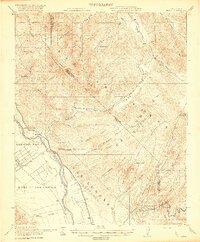
1921 Map of Metz
USGS Topo · Published 1921About this map
The Gabilan Range dominates the central landscape of this 1921 survey, where the rugged topography transitions into the fertile agricultural flats of Arroyo Seco and Posa de los Ositos. Following the corridor of the Salinas River, the Southern Pacific railroad connects early 20th-century outposts like Metz and Greenfield. This era shows the region's early cattle and ranching heritage through numerous family holdings, including Schmidt Ranch, Coburn Ranch, and Breen Ranch, many of which are tucked into the canyons of the Soberanes land grant.
Find a feature on this map
46 named features on this map. Tap any name to fly to it.
Don’t see what you’re looking for? This feature index may not catch every label — zoom into the map to look around manually.
Map Details
Editions of this 1921 Metz Map
4 editions found
Other maps of this area

1912 · Metz
USGS Topo · 1:31,680

1913 · Panoche
USGS Topo · 1:125,000

1915 · Soledad
USGS Topo · 1:62,500

1915 · Priest Valley
USGS Topo · 1:125,000

1919 · King City
USGS Topo · 1:62,500

1919 · San Benito
USGS Topo · 1:62,500

1919 · Junipero Serra
USGS Topo · 1:62,500

1921 · Gonzales
USGS Topo · 1:62,500

1921 · Metz
USGS Topo · 1:62,500

1931 · San Benito
USGS Topo · 1:62,500