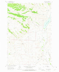
1963 Map of Metzel Ranch
USGS Topo · Published 1975About this map
Metzel Ranch and the surrounding rangelands of Madison County are defined by a complex network of irrigation and livestock infrastructure near the Ruby River. At the time of this 1963 field check, the landscape was dotted with family-named homesteads and camps, including Kingrey Place, Maloney Ranch, and Ball Place. The presence of the Upper Ruby Sch and the Upper Ruby Cem near the river indicates a established rural community tied to the local water sources.
Find a feature on this map
50 named features on this map. Tap any name to fly to it.
Don’t see what you’re looking for? This feature index may not catch every label — zoom into the map to look around manually.
Map Details
Editions of this 1963 Metzel Ranch Map
2 editions found
Other maps of this area

1893 · Dillon
USGS Topo · 1:250,000

1955 · Dillon
USGS Topo · 1:250,000

1957 · Dillon
USGS Topo · 1:250,000

1958 · Dillon
USGS Topo · 1:250,000

1961 · Mine Gulch
USGS Topo · 1:24,000

1961 · Red Canyon
USGS Topo · 1:24,000

1961 · Beaverhead Rock SE
USGS Topo · 1:24,000

1962 · Dillon
USGS Topo · 1:250,000
1963 · Metzel Ranch
USGS Topo · 1:24,000
1963 · Home Park Ranch
USGS Topo · 1:24,000