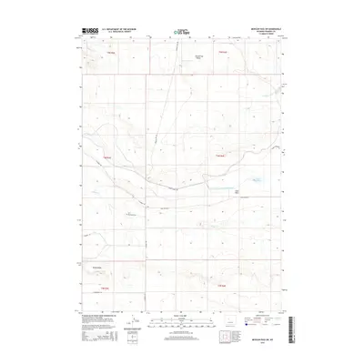
2015 Map of Mexican Pass SW
USGS Topo · Published 2015About this map
Burnaugh Cem sits as a quiet landmark within the high desert landscape of Fremont County, marking the human history of this arid region. The terrain is defined by the significant rise of Sand Mesa and the nearby Muddy Ridge, which influence the local drainage patterns of Cottonwood Creek and Muddy Creek. Water management is central to the area's utility, evidenced by the Upper Reservoir and the Badger Wasteway situated between the mesas. A network of rural arteries, including Mexican Pass Rd and Sand Mesa Rd, connects the scattered topographic features and provides access through the expansive draws such as Red Springs Draw. The map illustrates the 21st-century transition of this Western landscape, where traditional land use meets modern infrastructure like the E Powerline Rd.
Find a feature on this map
21 named features on this map. Tap any name to fly to it.
Don’t see what you’re looking for? This feature index may not catch every label — zoom into the map to look around manually.
Map Details
Editions of this 2015 Mexican Pass SW Map
This is the sole edition of this map. No revisions or reprints were ever made.
Other maps of this area

1950 · Harris Bridge
USGS Topo · 1:24,000

1950 · Mexican Pass SW
USGS Topo · 1:24,000

1950 · Ocean Lake
USGS Topo · 1:24,000

1951 · Mexican Pass SE
USGS Topo · 1:24,000

1951 · Mexican Pass
USGS Topo · 1:24,000

1951 · Morrison Canyon
USGS Topo · 1:24,000

1951 · Jenkins Mountain
USGS Topo · 1:24,000

1952 · Riverton NE
USGS Topo · 1:24,000

1952 · Lost Wells Butte
USGS Topo · 1:24,000

1955 · Thermopolis
USGS Topo · 1:250,000