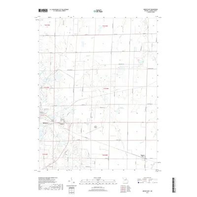
2017 Map of Mexico East
USGS Topo · Published 2017About this map
The eastern edges of Mexico define the western border of this landscape, where the urban grid meets the agricultural reaches of Audrain County. The terrain is characterized by a transition from the South Fork Salt River drainage in the west toward the headwaters of the W Fork Cuivre River in the southeast. This hydrological divide is marked by a network of small creeks like Littleby Cr and Wildcat Cr, alongside localized water bodies such as Burlington Lake and Teal Lake.
Find a feature on this map
79 named features on this map. Tap any name to fly to it.
Don’t see what you’re looking for? This feature index may not catch every label — zoom into the map to look around manually.
Map Details
Editions of this 2017 Mexico East Map
This is the sole edition of this map. No revisions or reprints were ever made.
Other maps of this area

1890 · Mexico
USGS Topo · 1:125,000

1932 · Mexico
USGS Topo · 1:62,500

1942 · Wellsville
USGS Topo · 1:62,500

1945 · Florida
USGS Topo · 1:62,500

1945 · Perry
USGS Topo · 1:62,500

1948 · Quincy
USGS Topo · 1:250,000

1956 · Quincy
USGS Topo · 1:250,000
1972 · Mexico East
USGS Topo · 1:24,000
1972 · Molino
USGS Topo · 1:24,000
1972 · Auxvasse
USGS Topo · 1:24,000