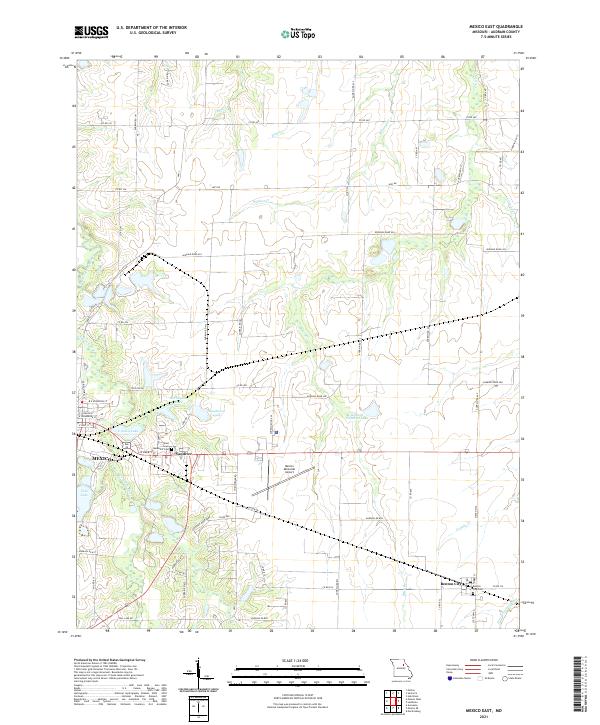
2021 Map of Mexico East
USGS Topo · Published 2021About this map
Mexico serves as the focal point for this section of Audrain County, where the eastern edges of the city give way to a landscape of agricultural fields and managed water bodies. The terrain is defined by the headwaters and tributaries of several river systems, including the South Fork Salt River and Littleby Cr. Notable local landmarks like the Mexico Memorial Airport and the nearby village of Vandiver illustrate the mid-century development patterns of the region.
Find a feature on this map
71 named features on this map. Tap any name to fly to it.
Don’t see what you’re looking for? This feature index may not catch every label — zoom into the map to look around manually.
Map Details
Editions of this 2021 Mexico East Map
This is the sole edition of this map. No revisions or reprints were ever made.
Other maps of this area

1890 · Mexico
USGS Topo · 1:125,000

1932 · Mexico
USGS Topo · 1:62,500

1942 · Wellsville
USGS Topo · 1:62,500

1945 · Florida
USGS Topo · 1:62,500

1945 · Perry
USGS Topo · 1:62,500

1948 · Quincy
USGS Topo · 1:250,000

1956 · Quincy
USGS Topo · 1:250,000
1972 · Mexico East
USGS Topo · 1:24,000
1972 · Molino
USGS Topo · 1:24,000
1972 · Auxvasse
USGS Topo · 1:24,000