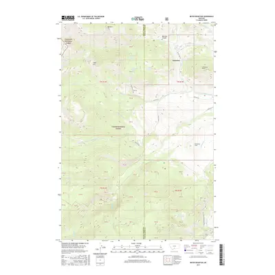
2017 Map of Meyer Mountain
USGS Topo · Published 2017About this map
Gallatin National Forest and Custer National Forest meet in this mountainous region where the border of Sweet Grass and Stillwater counties divides the high terrain. The settlement of Limestone serves as a lone point of habitation near the eastern edge, situated between Meyers Creek and the prominent Limestone Butte. The landscape is defined by its complex drainage network, where Picket Pin Cr and Castle Cr carve through the center of the quadrangle. High-altitude landmarks such as Meyer Mtn and Washburn Mtn overlook a series of natural springs, including Quaker Spring and North Pass Creek Spring. To the south, the topography transitions toward Mountain View Lake, fed by Mountain View Cr, illustrating the vital watershed that feeds into Stillwater Cr.
Find a feature on this map
38 named features on this map. Tap any name to fly to it.
Don’t see what you’re looking for? This feature index may not catch every label — zoom into the map to look around manually.
Map Details
Editions of this 2017 Meyer Mountain Map
This is the sole edition of this map. No revisions or reprints were ever made.
Other maps of this area

1891 · Livingston
USGS Topo · 1:250,000

1891 · Big Timber
USGS Topo · 1:125,000

1893 · Livingston
USGS Topo · 1:250,000

1893 · Big Timber
USGS Topo · 1:125,000

1898 · Granite Mountain District
USGS Topo · 1:125,000

1932 · Nye No 2
USGS Topo · 1:48,000

1939 · Mt Wood
USGS Topo · 1:62,500

1941 · Mt. Wood
USGS Topo · 1:62,500

1941 · Mt Douglas
USGS Topo · 1:62,500

1943 · Mt Douglas
USGS Topo · 1:62,500