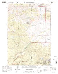
1996 Map of Meyer Mountain
USGS Topo · Published 1999About this map
Meyer Mountain and the high ridges of the Beartooth range dominate this mid-1990s survey of the Montana high country. The landscape is defined by the convergence of major forest boundaries, including the Gallatin National Forest, Custer National Forest, and the northern reaches of the Absaroka Beartooth Wilderness. Water sources are abundant throughout these slopes, from Whittaker Spring and Quaker Spring to the higher elevations of Mountain View Lake.
Find a feature on this map
41 named features on this map. Tap any name to fly to it.
Don’t see what you’re looking for? This feature index may not catch every label — zoom into the map to look around manually.
Map Details
Editions of this 1996 Meyer Mountain Map
This is the sole edition of this map. No revisions or reprints were ever made.
Other maps of this area

1891 · Livingston
USGS Topo · 1:250,000

1891 · Big Timber
USGS Topo · 1:125,000

1893 · Livingston
USGS Topo · 1:250,000

1893 · Big Timber
USGS Topo · 1:125,000

1898 · Granite Mountain District
USGS Topo · 1:125,000

1932 · Nye No 2
USGS Topo · 1:48,000

1939 · Mt Wood
USGS Topo · 1:62,500

1941 · Mt. Wood
USGS Topo · 1:62,500

1941 · Mt Douglas
USGS Topo · 1:62,500

1943 · Mt Douglas
USGS Topo · 1:62,500