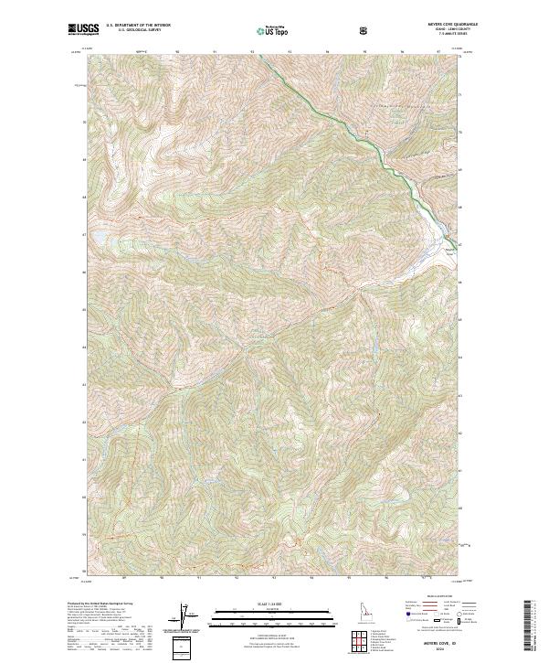
2024 Map of Meyers Cove
USGS Topo · Published 2024About this map
Meyers Cove sits at the confluence of several high-mountain waterways, marking a focal point for backcountry travel in this portion of the Yellowjacket Mountains. The landscape is dominated by the intersection of the Salmon National Forest, the Challis National Forest, and the protected expanses of the Frank Church-River of No Return Wilderness. The map reveals a legacy of resource extraction centered on Fluorspar Ridge and the adjacent Fluorspar Gulch, where naming conventions hint at the mineral exploration that once defined these remote slopes.
Find a feature on this map
38 named features on this map. Tap any name to fly to it.
Don’t see what you’re looking for? This feature index may not catch every label — zoom into the map to look around manually.
Map Details
Editions of this 2024 Meyers Cove Map
This is the sole edition of this map. No revisions or reprints were ever made.
Other maps of this area

1930 · Casto
USGS Topo · 1:125,000

1956 · Twin Peaks
USGS Topo · 1:62,500

1957 · Challis
USGS Topo · 1:250,000

1960 · Challis
USGS Topo · 1:250,000

1963 · Challis
USGS Topo · 1:250,000

1963 · Meyers Cove
USGS Topo · 1:24,000

1963 · Rock Creek
USGS Topo · 1:24,000
1963 · Aparejo Point
USGS Topo · 1:24,000
1963 · Yellowjacket
USGS Topo · 1:24,000
1963 · Duck Creek Point
USGS Topo · 1:24,000