
1939 Map of Meyersdale
USGS Topo · Published 1955About this map
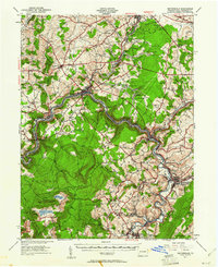
The Casselman River snakes through the center of this Somerset County landscape, dictating the development of the Baltimore and Ohio Railroad and the industrial towns that line its banks. This 1939 era survey highlights the intersection of heavy transit and resource extraction, with the Wilson Creek Mines and Allegheny Mines operating near the steep river valleys. In the southwest, Mt Davis rises as the high point of the region, surrounded by smaller agrarian settlements like Markleton and Pinkerton.
Find a feature on this map
100 named features on this map. Tap any name to fly to it.
Don’t see what you’re looking for? This feature index may not catch every label — zoom into the map to look around manually.
Map Details
Editions of this 1939 Meyersdale Map
2 editions found
Other maps of this area

1898 · Frostburg
USGS Topo · 1:62,500

1899 · Grantsville
USGS Topo · 1:62,500

1900 · Accident
USGS Topo · 1:62,500

1901 · Frostburg
USGS Topo · 1:62,500

1904 · Grantsville
USGS Topo · 1:62,500

1908 · Frostburg
USGS Topo · 1:62,500

1913 · Somerset
USGS Topo · 1:62,500

1914 · Windber
USGS Topo · 1:62,500

1915 · Somerset
USGS Topo · 1:62,500

1916 · Windber
USGS Topo · 1:62,500