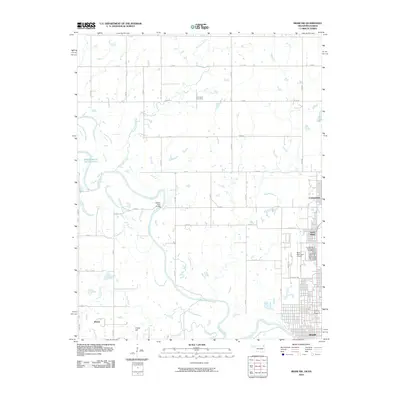
2010 Map of Miami NW
USGS Topo · Published 2010About this map
The Neosho River meanders through this portion of Ottawa County, creating a riparian corridor that separates the industrial and residential centers of the east from the agricultural expanses to the west. On the eastern bank, the urban footprint of Miami, North Miami, and Commerce reflects the region's development, anchored by infrastructure like the Miami Municipal Airport. Cultural history is anchored in sites such as the Old Indian Cemetery in the northern section and the Grand Army of the Republic Cemetery near the city limits. The river remains a central geographic feature, with the Stepps Ford Bridge providing a key crossing point, while smaller tributaries like Fourmile Creek and Windy Creek drain the surrounding fields. To the southwest, Potato Hill rises above the terrain, overlooking the small settlement of Dawes and the northern reaches of Grand Lake O' The Cherokees.
Find a feature on this map
41 named features on this map. Tap any name to fly to it.
Don’t see what you’re looking for? This feature index may not catch every label — zoom into the map to look around manually.
Map Details
Editions of this 2010 Miami NW Map
This is the sole edition of this map. No revisions or reprints were ever made.
Other maps of this area

1886 · Joplin
USGS Topo · 1:125,000

1886 · Parsons
USGS Topo · 1:125,000

1893 · Parsons
USGS Topo · 1:125,000

1894 · Joplin
USGS Topo · 1:125,000

1901 · Vinita
USGS Topo · 1:125,000

1907 · Wyandotte
USGS Topo · 1:125,000

1909 · Wyandotte
USGS Topo · 1:125,000

1913 · Vinita
USGS Topo · 1:125,000

1918 · Columbus
USGS Topo · 1:62,500

1944 · Oswego
USGS Topo · 1:62,500