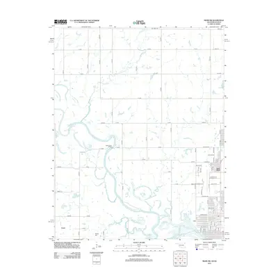
2012 Map of Miami NW
USGS Topo · Published 2012About this map
The northern reaches of Grand Lake O' the Cherokees dominate this portion of Ottawa County, where the meandering water system defines the local geography. The settlement of North Miami is positioned at the eastern edge, showing its grid of streets such as Newman Rd and Goodrich Blvd near the Miami Municipal Airport. Significant for local history and genealogy, the Grand Army of the Republic Cem serves as a prominent landmark north of the airport. Further west, the landscape is shaped by numerous tributaries including Fourmile Cr, Squaw Cr, and Mud Cr. The terrain features isolated high points like Potato Hill, while historical crossing points are marked by the Stepps Ford Bridge over the winding river channel. The small community of Dawes sits in the southwestern corner, connected by a network of rural routes like E 90 Rd.
Find a feature on this map
32 named features on this map. Tap any name to fly to it.
Don’t see what you’re looking for? This feature index may not catch every label — zoom into the map to look around manually.
Map Details
Editions of this 2012 Miami NW Map
This is the sole edition of this map. No revisions or reprints were ever made.
Other maps of this area

1886 · Joplin
USGS Topo · 1:125,000

1886 · Parsons
USGS Topo · 1:125,000

1893 · Parsons
USGS Topo · 1:125,000

1894 · Joplin
USGS Topo · 1:125,000

1901 · Vinita
USGS Topo · 1:125,000

1907 · Wyandotte
USGS Topo · 1:125,000

1909 · Wyandotte
USGS Topo · 1:125,000

1913 · Vinita
USGS Topo · 1:125,000

1918 · Columbus
USGS Topo · 1:62,500

1944 · Oswego
USGS Topo · 1:62,500