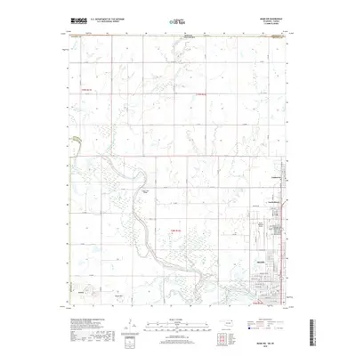
2018 Map of Miami NW
USGS Topo · Published 2018About this map
The Neosho River winds through the heart of Ottawa County, framing the northern outskirts of Miami and neighboring North Miami. This 2018 survey captures the interface between the urban grid and the river's extensive floodplain, marked by landmarks like the Stepps Ford Bridge and the sprawling grounds of the Grand Army of the Republic Cem. The map illustrates a landscape of modern infrastructure, such as the Miami Regional Airport, alongside legacy features like Dawes and the topographic rise of Potato Hill. To the north, the border between Kansas and Oklahoma is defined by Treece Rd, while the area's hydrology is further detailed by Squaw Creek and Fourmile Creek. The residential expansion of Commerce is visible in the northeast, showing the continued development of this historic lead and zinc mining region.
Find a feature on this map
51 named features on this map. Tap any name to fly to it.
Don’t see what you’re looking for? This feature index may not catch every label — zoom into the map to look around manually.
Map Details
Editions of this 2018 Miami NW Map
This is the sole edition of this map. No revisions or reprints were ever made.
Other maps of this area

1886 · Joplin
USGS Topo · 1:125,000

1886 · Parsons
USGS Topo · 1:125,000

1893 · Parsons
USGS Topo · 1:125,000

1894 · Joplin
USGS Topo · 1:125,000

1901 · Vinita
USGS Topo · 1:125,000

1907 · Wyandotte
USGS Topo · 1:125,000

1909 · Wyandotte
USGS Topo · 1:125,000

1913 · Vinita
USGS Topo · 1:125,000

1918 · Columbus
USGS Topo · 1:62,500

1944 · Oswego
USGS Topo · 1:62,500