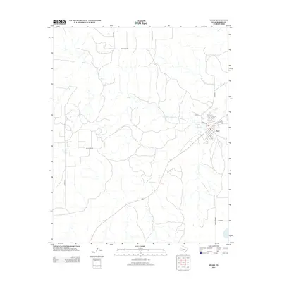
2012 Map of Miami
USGS Topo · Published 2012About this map
Miami serves as the focal point of this Panhandle landscape, situated along the banks of Red Deer Cr. The town layout is clearly defined by a grid of local streets, including NW Main St and Harvey St, reflecting its position as the county seat of Roberts County. The surrounding terrain is primarily characterized by the drainage systems of Bluff Cr and its various tributaries, which carve through the high plains. A network of rural routes, such as Ranch Road 282 and Rankin Rd, connects isolated ranching operations to the settlement center. This survey provides a clear look at the contemporary infrastructure of the region, from the residential core of Miami to the more distant reaches along Quarter Horse Rd.
Find a feature on this map
17 named features on this map. Tap any name to fly to it.
Don’t see what you’re looking for? This feature index may not catch every label — zoom into the map to look around manually.
Map Details
Editions of this 2012 Miami Map
This is the sole edition of this map. No revisions or reprints were ever made.
Other maps of this area

1954 · Amarillo
USGS Topo · 1:250,000

1958 · Amarillo
USGS Topo · 1:250,000

1966 · Laketon
USGS Topo · 1:24,000

1967 · Hoover
USGS Topo · 1:24,000

1967 · Tody School
USGS Topo · 1:24,000

1967 · Lora
USGS Topo · 1:24,000

1971 · Dry Creek SE
USGS Topo · 1:24,000

1972 · Washburn Arroyo
USGS Topo · 1:24,000

1972 · Pampa NE
USGS Topo · 1:24,000

1972 · Miami
USGS Topo · 1:24,000