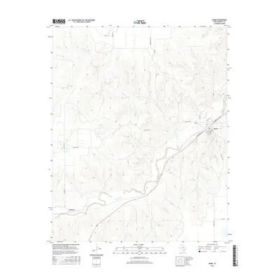
2016 Map of Miami
USGS Topo · Published 2016About this map
Miami serves as the focal point of this Roberts County landscape, situated where the high plains break into the drainage systems of the Panhandle. The town’s grid is centered on the intersection of E Commercial St and S Main St, reflecting a layout typical of the region’s railroad-dependent settlements. Outside the town center, the terrain is defined by the winding course of Red Deer Creek and its various tributaries, including Bluff Cr and Horse Cr, which carve deep contours into the surrounding ranch land. To the southwest, the small locality of Codman sits along the rail line, connected by Codman Ln to the arterial Ranch Rd 282. This network of rural routes, such as Rankin Rd and Quarter Horse Rd, illustrates the sprawling nature of Texas cattle country and the infrastructure required to support its remote agricultural operations.
Find a feature on this map
24 named features on this map. Tap any name to fly to it.
Don’t see what you’re looking for? This feature index may not catch every label — zoom into the map to look around manually.
Map Details
Editions of this 2016 Miami Map
This is the sole edition of this map. No revisions or reprints were ever made.
Other maps of this area

1954 · Amarillo
USGS Topo · 1:250,000

1958 · Amarillo
USGS Topo · 1:250,000

1966 · Laketon
USGS Topo · 1:24,000

1967 · Hoover
USGS Topo · 1:24,000

1967 · Tody School
USGS Topo · 1:24,000

1967 · Lora
USGS Topo · 1:24,000

1971 · Dry Creek SE
USGS Topo · 1:24,000

1972 · Washburn Arroyo
USGS Topo · 1:24,000

1972 · Pampa NE
USGS Topo · 1:24,000

1972 · Miami
USGS Topo · 1:24,000