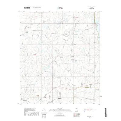
2018 Map of Miccosukee
USGS Topo · Published 2018About this map
The community of Miccosukee and the surrounding borderlands of Leon and Jefferson counties are defined by a complex network of wetlands and small lakes. Centered on the historic settlement of Miccosukee, this modern survey illustrates a landscape of established rural clusters like Concord, Felkel, and Wadesboro. The eastern edge is dominated by the expansive Lake Miccosukee, while the interior terrain is dotted with distinctive named ponds such as Beer Can Pond, Alligator Pond, and Sanders Hammock Pond. Local history is preserved through several burial grounds, including Halls Cem, Runner Cem, and Miccosukee Cem. Transportation patterns are anchored by rural thoroughfares like Moccasin Gap Rd and Old Centerville Rd, while local aviation is served by Ingalls Field and Black Creek Pass Airport. The distribution of sinks like Hammock Sink and seasonal water bodies such as Cody Pond reflects the unique karst topography of the Florida Panhandle.
Find a feature on this map
127 named features on this map. Tap any name to fly to it.
Don’t see what you’re looking for? This feature index may not catch every label — zoom into the map to look around manually.
Map Details
Editions of this 2018 Miccosukee Map
This is the sole edition of this map. No revisions or reprints were ever made.
Other maps of this area

1954 · Lloyd
USGS Topo · 1:24,000

1954 · Lafayette
USGS Topo · 1:24,000

1954 · Valdosta
USGS Topo · 1:250,000

1954 · Tallahassee
USGS Topo · 1:250,000

1955 · Waukeenah
USGS Topo · 1:24,000

1956 · Metcalf
USGS Topo · 1:24,000

1957 · Beachton
USGS Topo · 1:24,000

1957 · Miccosukee NE
USGS Topo · 1:24,000

1958 · Valdosta
USGS Topo · 1:250,000

1959 · Tallahassee
USGS Topo · 1:250,000