
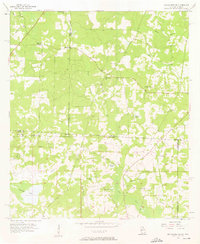
1957 Map of Miccosukee NE
USGS Topo · Published 1958About this map
The Georgia-Florida state line bisects this 1957 survey, illustrating a landscape of scattered rural congregations and isolated water bodies. Numerous churches such as Mercy Seat Ch, Antioch Ch, and St Philip Ch serve as local landmarks across the undulating terrain of Thomas and Leon counties. The hydrology of the region is defined by a series of named ponds and creeks, including Original Pond, Murray Pond, and Gin House Pond, which drain southward toward the larger Foshalee Lake. The distribution of these water sources and religious sites, alongside family-named markers like Copeland Cem and Spring Hill Cem, provides a clear view of the mid-century settlement pattern in this agricultural borderland before significant modern development altered the local road networks and land use.
Find a feature on this map
28 named features on this map. Tap any name to fly to it.
Don’t see what you’re looking for? This feature index may not catch every label — zoom into the map to look around manually.
Map Details
Editions of this 1957 Miccosukee NE Map
2 editions found
Other maps of this area

1954 · Valdosta
USGS Topo · 1:250,000

1954 · Tallahassee
USGS Topo · 1:250,000

1956 · Cairo
USGS Topo · 1:62,500

1956 · Metcalf
USGS Topo · 1:24,000

1957 · Beachton
USGS Topo · 1:24,000

1957 · Thomasville
USGS Topo · 1:62,500

1958 · Valdosta
USGS Topo · 1:250,000

1959 · Tallahassee
USGS Topo · 1:250,000

1959 · Valdosta
USGS Topo · 1:250,000

1960 · Tallahassee
USGS Topo · 1:250,000