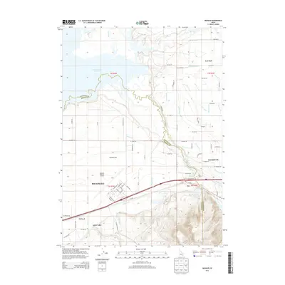
2013 Map of Michaud
USGS Topo · Published 2013About this map
The American Falls Reservoir defines the northwest corner of this landscape, where the waters of the Portneuf River and Ross Fork converge. The terrain transitions from the open expanses of Michaud Flats to the growing urban corridors of Pocatello and Chubbuck in the southeast. This 2013 survey illustrates a complex water management system essential to the Snake River Plain, featuring an intricate network of irrigation channels including the Taghee Canal, DuBois Lateral, and Tyhee Lateral.
Find a feature on this map
114 named features on this map. Tap any name to fly to it.
Don’t see what you’re looking for? This feature index may not catch every label — zoom into the map to look around manually.
Map Details
Editions of this 2013 Michaud Map
This is the sole edition of this map. No revisions or reprints were ever made.
Other maps of this area

1934 · Michaud
USGS Topo · 1:62,500

1937 · Pocatello
USGS Topo · 1:48,000

1937 · Michaud
USGS Topo · 1:62,500

1940 · Blackfoot
USGS Topo · 1:62,500

1943 · Blackfoot
USGS Topo · 1:62,500

1944 · Pocatello
USGS Topo · 1:62,500

1954 · Pocatello
USGS Topo · 1:250,000

1955 · Pingree
USGS Topo · 1:24,000

1955 · Springfield
USGS Topo · 1:24,000

1955 · Idaho Falls
USGS Topo · 1:250,000