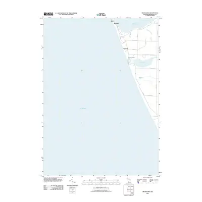
2011 Map of Michillinda
USGS Topo · Published 2011About this map
Lake Michigan dominates the western half of this shoreline survey, defining the coastal character of Fruitland Township. Along the eastern edge, a string of lakeside communities including Wabaningo, Michillinda, and Sylvan Beach sit between the big lake and the inland waters of White Lake. The landscape is defined by the transition from open water to protected harbors and small inland basins like Muskrat Lake and Duck Lake.
Find a feature on this map
24 named features on this map. Tap any name to fly to it.
Don’t see what you’re looking for? This feature index may not catch every label — zoom into the map to look around manually.
Map Details
Editions of this 2011 Michillinda Map
This is the sole edition of this map. No revisions or reprints were ever made.
Other maps of this area

1929 · Montague
USGS Topo · 1:48,000

1930 · Lake Harbor
USGS Topo · 1:48,000

1936 · Lake Harbor
USGS Topo · 1:62,500

1954 · Milwaukee
USGS Topo · 1:250,000

1958 · Milwaukee
USGS Topo · 1:250,000

1959 · Montague
USGS Topo · 1:62,500
1972 · Muskegon West
USGS Topo · 1:24,000

1976 · Montague NW
USGS Topo · 1:24,000

1976 · Montague SW
USGS Topo · 1:24,000
1976 · Montague NE
USGS Topo · 1:24,000
Featured Places
- Wabaningo, MI
- White River Township, MI
- Fruitland Township, MI
- Laketon Township, MI
- Montague Township, MI