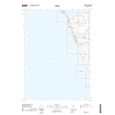
2019 Map of Michillinda
USGS Topo · Published 2019About this map
Lake Michigan dominates the western half of this shoreline survey, shaping the coastal geography of Fruitland Township. The lakeside communities of Michillinda and Wabaningo are situated on the narrow strip of land between the great lake and the inland waters of White Lake and Duck Lake. This area is characterized by a dense network of coastal roads like N Scenic Dr and S Shore Dr, which serve the established residential settlements and seasonal retreats that have long defined this portion of the Muskegon County coast. Inland, the landscape transitions toward the drainage of Strawberry Cr. Genealogists and local historians can locate the Duck Lake Cem near the junction of Todd Rd, a central landmark for tracing family roots in this lakeside community. The map also delineates the northern reach of Sylvan Beach and the winding course of Duck Lake Rd as it approaches the lakefront.
Find a feature on this map
28 named features on this map. Tap any name to fly to it.
Don’t see what you’re looking for? This feature index may not catch every label — zoom into the map to look around manually.
Map Details
Editions of this 2019 Michillinda Map
This is the sole edition of this map. No revisions or reprints were ever made.
Other maps of this area

1929 · Montague
USGS Topo · 1:48,000

1930 · Lake Harbor
USGS Topo · 1:48,000

1936 · Lake Harbor
USGS Topo · 1:62,500

1954 · Milwaukee
USGS Topo · 1:250,000

1958 · Milwaukee
USGS Topo · 1:250,000

1959 · Montague
USGS Topo · 1:62,500
1972 · Muskegon West
USGS Topo · 1:24,000

1976 · Montague NW
USGS Topo · 1:24,000
1976 · Montague SW
USGS Topo · 1:24,000
1976 · Montague NE
USGS Topo · 1:24,000
Featured Places
- Wabaningo, MI
- White River Township, MI
- Fruitland Township, MI
- Laketon Township, MI
- Montague Township, MI