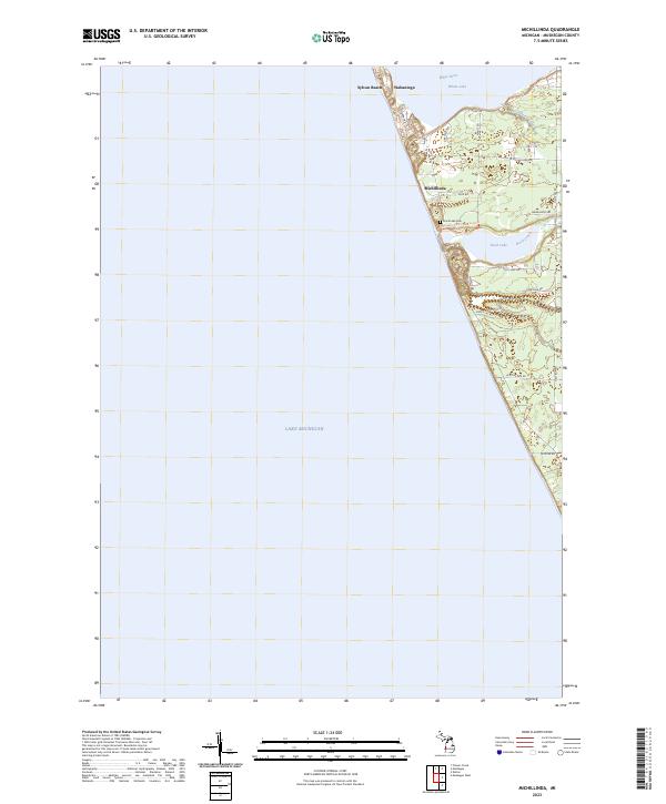
2023 Map of Michillinda
USGS Topo · Published 2023About this map
Lake Michigan dominates the western half of this coastal area, where the shoreline is defined by the narrow peninsulas and inlets of the White River and White Lake. The settlement of Wabaningo sits at the northern inlet, while Michillinda and Sylvan Beach occupy the coastal strip further south. The geography here is a classic Great Lakes transition, where river systems like Strawberry Creek and Duck Creek feed into larger lakes before meeting the open water.
Find a feature on this map
30 named features on this map. Tap any name to fly to it.
Don’t see what you’re looking for? This feature index may not catch every label — zoom into the map to look around manually.
Map Details
Editions of this 2023 Michillinda Map
This is the sole edition of this map. No revisions or reprints were ever made.
Other maps of this area

1929 · Montague
USGS Topo · 1:48,000

1930 · Lake Harbor
USGS Topo · 1:48,000

1936 · Lake Harbor
USGS Topo · 1:62,500

1954 · Milwaukee
USGS Topo · 1:250,000

1958 · Milwaukee
USGS Topo · 1:250,000

1959 · Montague
USGS Topo · 1:62,500
1972 · Muskegon West
USGS Topo · 1:24,000

1976 · Montague NW
USGS Topo · 1:24,000

1976 · Montague SW
USGS Topo · 1:24,000
1976 · Montague NE
USGS Topo · 1:24,000